Dangerous cold and icy roads to persist through Tuesday
An Extreme Cold Warning continues through noon Monday and may be extended into Tuesday morning as no change in the Arctic airmass is expected.
The bands of freezing rain and sleet that coated Kerr County roads with ice are ending Sunday morning, but dangerous travel conditions and life-threatening cold will persist through at least Monday and likely into Tuesday.
The National Weather Service will maintain the Ice Storm Warning, Winter Storm Warning and Winter Weather Advisory through noon Sunday as many roads will remain ice-covered even though precipitation will have ended.
“Travel is not recommended across South-Central Texas,” the weather service stated early Sunday.
An Extreme Cold Warning continues through noon Monday and may be extended into Tuesday morning as no change in the Arctic airmass is expected.
Clear skies emerged overnight, but the sunshine that will help melt some ice Sunday also sets up a critical danger: Any water will quickly refreeze after sunset, making roads icy again Sunday night into Monday morning.
Power Outage Reported
Kerrville Public Utility Board reported a brief power outage Saturday at 8 a.m. that was restored by 10 a.m., demonstrating the vulnerability of infrastructure during ice accumulation events.
Ice Totals on Track
Total ice accumulations remain on track with forecasts. The Ice Storm Warning area covering the Hill Country received one-quarter to one-half inch of ice. Most of the remainder of the region under Winter Storm Warnings received one-tenth to one-quarter inch with isolated amounts of one-quarter to one-half inch. The Winter Weather Advisory area in the Winter Garden received up to one-tenth inch.
Sleet accumulations up to one-half inch are possible in most areas.
Roads across Kerr County are frozen and covered by sleet and freezing rain as of Sunday morning.
Precipitation Ending
The enhancement of precipitation ahead of an upper-level trough over the Big Bend moved through overnight, though the back edge was moving into Rio Grande areas early Sunday. Surface temperatures remain below freezing across all of South-Central Texas.
Atmospheric profiles continued to show a significant mid-level warm layer above freezing with a deepening lower-level subfreezing layer, producing a mix of freezing rain and sleet overnight. The trough will exit to the east shortly after sunrise, taking the precipitation with it.
Another upper-level trough passes overhead by early evening Sunday with a few snow flurries possible over Val Verde County where forecast soundings show the mid-level warm layer has eroded. However, no snow accumulations are expected.
Overnight Conditions
Overnight temperatures in Kerrville hovered in the mid-20s with fog and mist reported throughout the early morning hours. Northerly winds of 10 to 17 mph with gusts to 23 mph persisted through the night.
Dangerous Cold Continues
In addition to wintry precipitation, dangerously cold Arctic air continues across the region. Northerly winds of 10 to 20 mph with gusts to 30 mph will send wind chills as low as 5 below zero across northern areas and 5 degrees above zero across southern areas.
Lows in the teens are expected across most areas Sunday night into Monday morning, except for areas of single digits in the Hill Country and lower 20s along the Rio Grande.
These conditions may cause hypothermia and frostbite if precautions are not taken. The weather service warns: “Keep people, pets, plants and pipes warm, and practice safe use of space heaters.”
Refreezing Danger
While clouds will break, allowing sunshine to melt some ice Sunday, any water will quickly refreeze after sunset, making roads icy again Sunday night into Monday morning. This refreezing cycle will prolong travel impacts into the work week.
Travel impacts could linger into Monday and Tuesday due to residual icy roads. A long-duration freeze is forecast for the Hill Country and Austin metro area through at least Monday morning.
Week Ahead Remains Cold
Although some temperature recovery is expected the remainder of the week, conditions will remain unseasonably cold. Freezes with areas of hard freezes are expected at night into early morning due to efficient radiational cooling, with only Thursday night mostly above freezing.
Temperatures will struggle to warm during the day due to mixing with cold air aloft. Fair skies will prevail due to dry northwesterly flow aloft.
Another Winter System Next Weekend
A cold front and upper-level trough will move across the area Friday into next weekend to generate precipitation. Forecast soundings from recent model runs indicate a mix of precipitation types due to a return of colder temperatures. However, models have been inconsistent and lack consensus.
Forecasts in coming days will provide more details on the potential for another winter weather event next weekend.
Stay Home
With roads frozen and covered by ice, residents must continue to shelter in place and avoid all travel Sunday. Power outages remain possible as ice-laden tree limbs could snap throughout the day.
Pet Shelter Available
Kerrville Pets Alive has set up a pet crate and supply area at Calvary Temple Church, 3000 Loop 534 in Kerrville. People and non-aggressive, crated pets are welcome. Pet owners in need may call 844-572-7387.
Animals in distress should be reported to Kerr County Animal Services at 830-257-3100, Kerrville Police Department at 830-257-8181 or the Kerr County Sheriff’s Office at 830-896-1133.
City Facilities
The city of Kerrville will reassess operations and communicate any changes impacting the week’s schedule through the city website and official social media channels.
For non-emergency issues, residents may contact the city at 830-257-8181.
Critical Safety Reminders
Residents should:
- Stay off all roads through Monday
- Keep pets indoors through extreme cold
- Use space heaters safely — never leave unattended
- Watch for refreezing after sunset Sunday
- Conserve food and water supplies
- Check on elderly neighbors by phone
- Know location of water shut-off valves
- Never use generators indoors
The city of Kerrville encourages everyone to continue staying safe and warm as dangerous conditions persist.
Author

Related Articles

Kerrville woman, 75, arrested after armed standoff with Hill Country SWAT team
Jenny Sprott was arrested shortly after midnight following a standoff that began when KPD officers responded at 11:29 p.m. Friday to a residence in the 1600 block of Quinlan Creek Road on a report of a domestic disturbance involving violence.
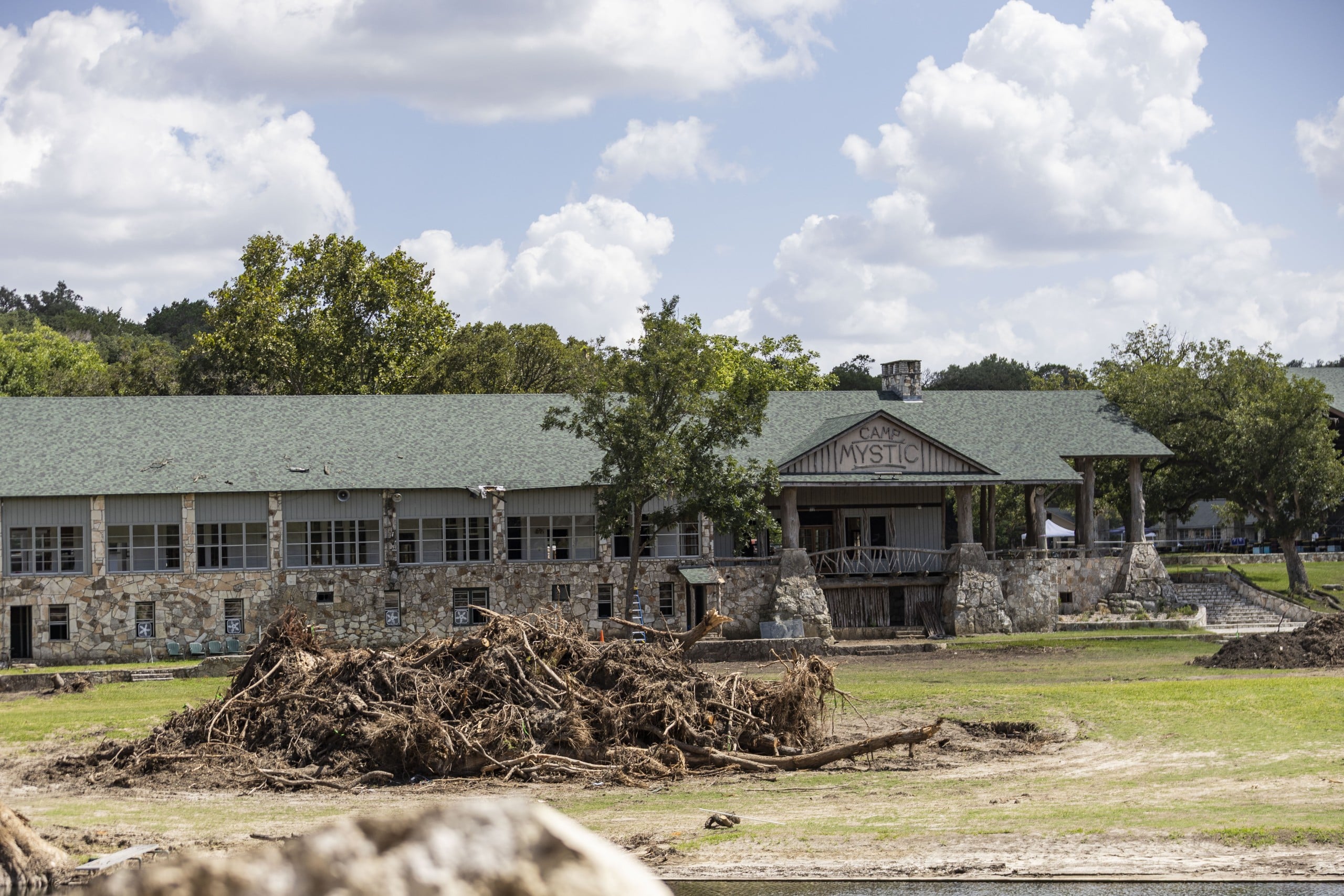
Camp Mystic arbitration battle plays out over morning of legal argument in Austin
The hearing before Judge Maya Guerra Gamble in Austin featured competing arguments on whether Camp Mystic and its co-defendants have already forfeited their right to demand arbitration — and whether the arbitration agreements are legally enforceable to begin with.
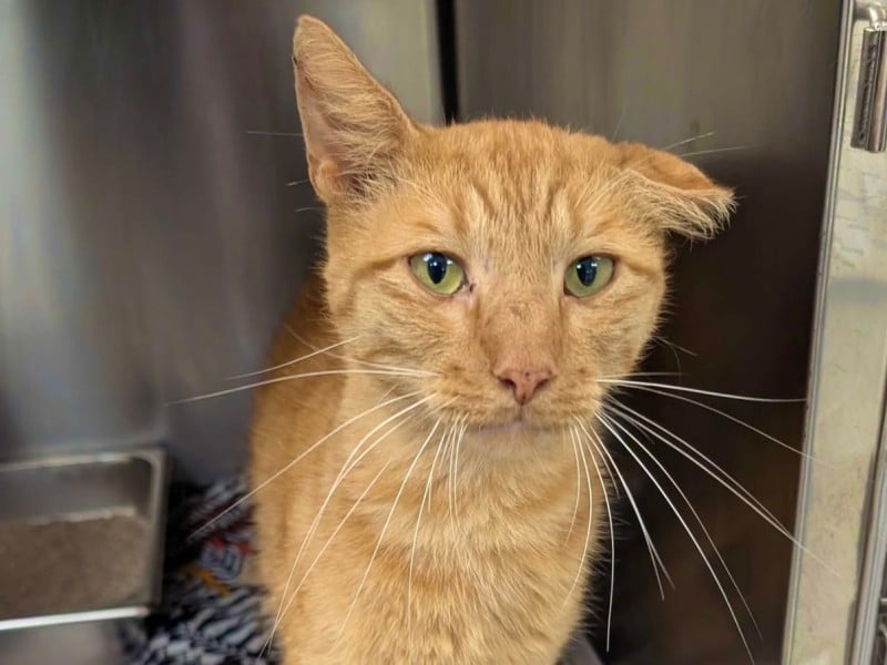
Kerrville Pets Alive! to host weekend adoption event with reduced fees
The nonprofit will cover half of adoption fees for the event. Fees include spay/neuter surgery, vaccinations and a microchip.
Comments (0)
There are no comments on this article.