Strong thunderstorms approaching Kerr County; expected to arrive by 8:45 p.m.
A line of strong thunderstorms was moving toward Kerr County Sunday evening and could arrive within the hour, the National Weather Service in Austin/San Antonio said.
At 8 p.m., radar showed the line extending from near Castell to near Telegraph, moving southeast at 45 mph. The NWS expects the storms to impact portions of Kerr County through approximately 8:45 p.m.
Wind gusts of 50 to 55 mph and nickel-size hail are possible. Gusty winds could knock down tree limbs and blow around unsecured objects.
Communities in the projected path include Kerrville, Ingram, Hunt, Harper and Mountain Home, among others.
This is a Special Weather Statement, not a warning. However, the National Weather Service cautions the storms may intensify. A Severe Thunderstorm Watch remains in effect for the area until midnight.
Author

Related Articles
Severe Thunderstorm Watch issued for Kerr County through midnight
A watch differs from a warning — a warning means severe weather is imminent or occurring and immediate action is required.

From ribbon cuttings to graduation, Kerr County’s week ahead is packed
A ribbon cutting in Hunt, Schreiner University’s commencement, a Gary P. Nunn benefit concert and a film about the Guadalupe River highlight a full week of community events across Kerr County.
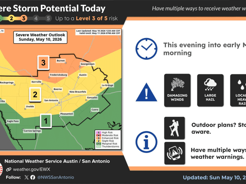
Severe storm threat moves into Kerr County tonight; damaging winds, large hail possible
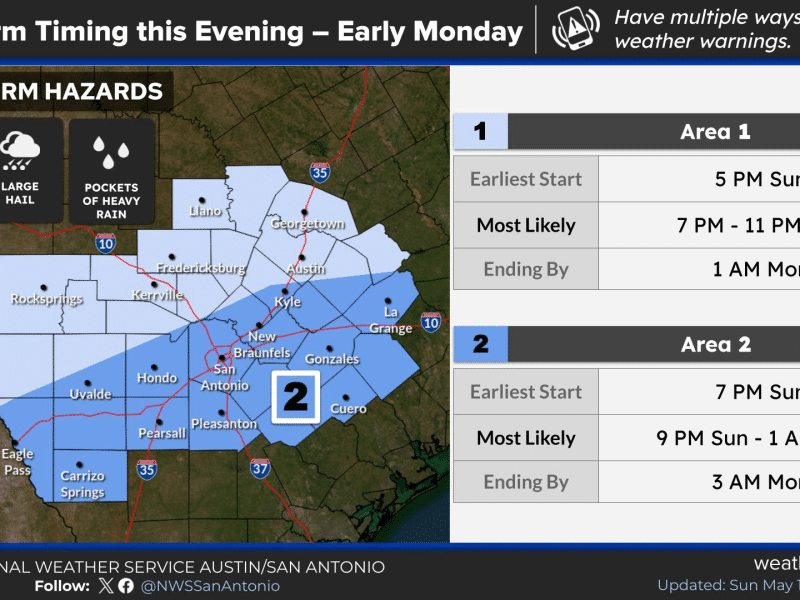
A cold front is expected to push through the Hill Country between 7 and 11 p.m. Sunday, bringing a line of strong to severe storms.
Comments (0)
There are no comments on this article.