Severe storm threat moves into Kerr County tonight; damaging winds, large hail possible
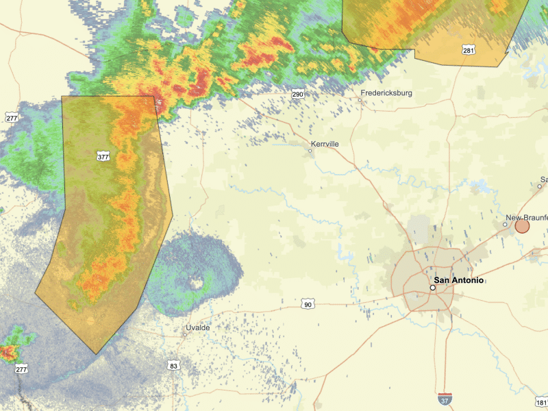
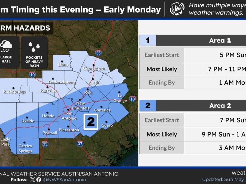
A cold front is expected to push through the Hill Country between 7 and 11 p.m. Sunday, bringing a line of strong to severe storms.
Kerr County is under an Enhanced risk — Level 3 of 5 — for severe thunderstorms Sunday evening into early Monday morning, according to the National Weather Service in Austin/San Antonio.
A cold front is expected to push through the Hill Country between 7 and 11 p.m. Sunday, bringing a line of strong to severe storms. The primary threats are damaging wind gusts that could exceed 75 mph and large hail. Locally heavy rainfall of 2 to 4 inches is also possible, with isolated totals of 5 to 6 inches in some areas.
The Enhanced risk covers the northern Hill Country and northern Interstate 35 corridor, including Georgetown and Burnet. Cities farther east, including Austin and San Antonio, fall under a Slight risk — Level 2 of 5.
Storm activity is expected to diminish after 1 a.m. Monday, with a slight chance of lingering showers and thunderstorms until about 4 a.m. Overnight lows will fall to around 64 degrees.
Monday brings a mostly cloudy to partly sunny sky with a high near 79. North winds of 10 to 15 mph, with gusts up to 20 mph, will follow the front through the day.
Residents should monitor conditions closely Sunday evening and have a plan to shelter quickly if warnings are issued. Updates will be posted at kerrcolead.com.
Author

Related Articles
Severe Thunderstorm Watch issued for Kerr County through midnight
A watch differs from a warning — a warning means severe weather is imminent or occurring and immediate action is required.

From ribbon cuttings to graduation, Kerr County’s week ahead is packed
A ribbon cutting in Hunt, Schreiner University’s commencement, a Gary P. Nunn benefit concert and a film about the Guadalupe River highlight a full week of community events across Kerr County.
Comments (0)
There are no comments on this article.