
Forecasters warn of ‘significant’ flood threat as moderate rainfall risk repeats for third straight day
Meteorologists with the National Weather Service’s Austin/San Antonio office said a morning weather balloon launch out of Del Rio measured 2.28 inches of precipitable water — moisture available in the atmosphere — which exceeded the daily record for the date.
Kerr County is bracing for what the National Weather Service is calling a rare, multi-day flood threat, with forecasters saying they haven’t seen back-to-back moderate excessive rainfall risks like this in more than a decade.
The advisory comes as a flood watch took effect for Kerr County and 20 other South Central Texas counties Monday, running from 9 p.m. through Thursday evening.
In an afternoon forecast discussion, meteorologists with the National Weather Service’s Austin/San Antonio office said a morning weather balloon launch out of Del Rio measured 2.28 inches of precipitable water — moisture available in the atmosphere — which exceeded the daily record for the date. The average for mid-July is around 1.5 inches, forecasters said. Similar moisture levels were showing up across most of South Central Texas by early afternoon.
Combined with weak wind shear, forecasters said the atmosphere is primed for “training” storms, where individual storm cells repeatedly move over the same areas. Rainfall rates within those storms could reach 2 to 4 inches per hour at times.
“This is a very moist airmass that we are dealing with and the right features in place to make it a significant one,” forecasters wrote.
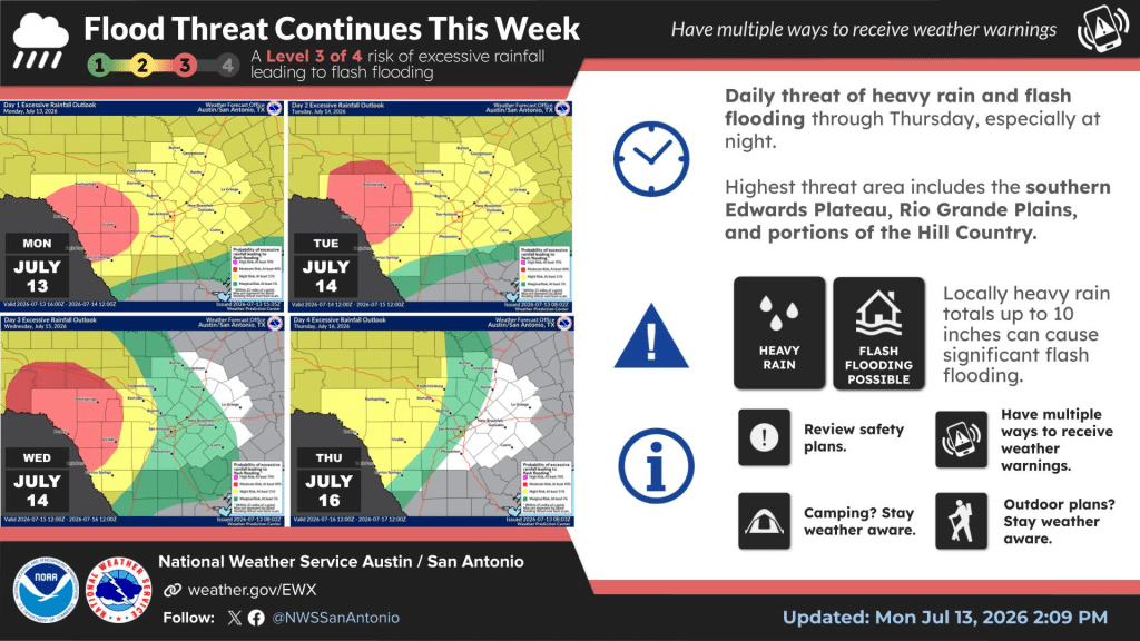
The Weather Prediction Center has placed a moderate risk — a level 3 out of 4 — for excessive rainfall over portions of the Rio Grande Plains and southern Edwards Plateau for three consecutive periods: tonight, Tuesday morning into Wednesday morning, and Wednesday morning into Thursday morning. Forecasters noted they had not seen back-to-back moderate risk designations like that in over a decade.
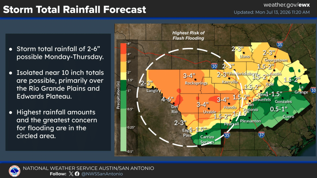
According to a storm total rainfall forecast the weather service issued Monday morning, Kerrville is projected to see 3 to 4 inches of rain from Monday through Thursday, with the highest amounts and greatest flooding concern centered over the Rio Grande Plains and southern Edwards Plateau — an area that includes parts of the Hill Country to Kerr County’s west. Isolated totals near 10 inches remain possible in that zone, forecasters said.
The threat is expected to build in waves. Heavy rain was forecast to develop through Monday afternoon and evening across the southern Edwards Plateau, the Hill Country and areas along and east of Interstate 35, then continue overnight. Forecasters said an increase in the low-level jet stream Tuesday evening will bring another round of heavy rain to the Hill Country, southern Edwards Plateau and Rio Grande Plains.
The wet pattern is expected to persist into Wednesday and Thursday as an upper-level disturbance stalls over West Texas, continuing to draw in tropical moisture. Forecasters said they could not rule out expanding the flood watch as the week progresses.
Relief is expected by Friday, when atmospheric moisture is forecast to drop off significantly. Daytime highs are expected to stay at or slightly below normal through the rest of the work week because of the rain and saturated soils, before rebounding into the 90s by the weekend.
Author

Related Articles
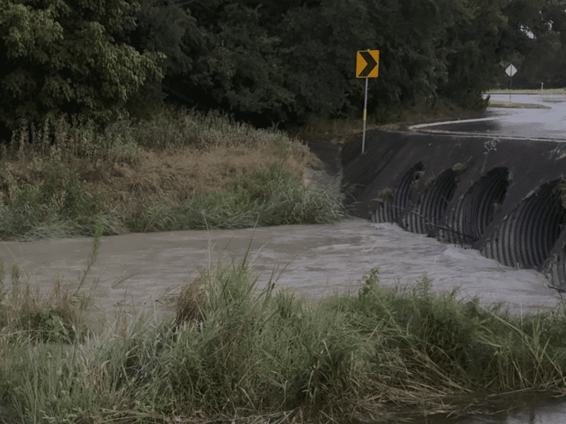
Flash flood warning issued for Kerr County as heavy rain triggers ‘considerable’ damage threat
Locations expected to see flash flooding include Kerrville, Ingram, Hunt, Vanderpool, Waltonia, Kerrville-Schreiner Park and Lost Maples State Natural Area.
Flood watch issued for Kerr County, much of South Central Texas through Thursday
The watch takes effect at 9 p.m. Monday and runs through Thursday evening. It covers Bandera, Bexar, Blanco, Burnet, Comal, Dimmit, Edwards, Frio, Gillespie, Hays, Kendall, Kerr, Kinney, Llano, Maverick, Medina, Real, Travis, Uvalde, Val Verde, Williamson and Zavala counties.

Nearly 100 ways to get out this week in Kerr County
The Lead counted roughly 94 listed happenings across the seven days, and that’s before factoring in the events that pop up last-minute on Facebook.
Comments (0)
There are no comments on this article.