Arctic blast could bring freezing rain, dangerous cold to Kerr County this weekend
Kerr County residents should begin preparing now for a dangerous Arctic cold front expected to arrive Friday, bringing potentially hazardous conditions through early next week.
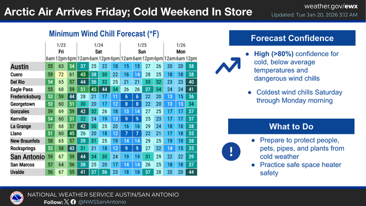
The National Weather Service says confidence is high for well-below-average temperatures and dangerous wind chills as the Arctic airmass settles over South-Central Texas this weekend. Forecasters place a 40 to 60 percent chance of at least minor winter weather impacts over the Hill Country, primarily from icy road conditions.
“While uncertainties remain in details for wintry precipitation this weekend, there is high confidence for cold, below average temperatures and dangerous wind chills,” the weather service stated Tuesday. “Now is the time to think about preparing for colder weather.”
The dramatic shift will follow several mild days. Highs will reach the 60s and 70s through Friday, with rain chances on Wednesday that are highest east of Interstate 35. The Arctic front is forecast to arrive Friday, though forecasters caution it could arrive earlier than current models indicate.
Behind the front, temperatures will plunge Saturday into early next week. Highs will struggle to reach the 30s and 40s, with overnight lows in the 20s. There is a 50 to 70 percent chance portions of the region could see lows below 20 degrees with even colder wind chills as north winds persist through the cold period.
“Hazardous cold temperatures are possible, especially Sunday morning and Monday morning when the coldest of the post-frontal airmass moves over the region,” forecasters wrote.
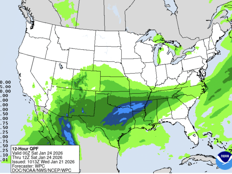
The weather service warns an “abnormally large supply of moisture” could intersect with the freezing temperatures, creating conditions for freezing rain and sleet. Rain is expected to begin Friday before temperatures are below freezing, then transition to a wintry mix from north to south Saturday into Sunday as subfreezing air undercuts the precipitation.
Model forecasts show precipitable water and moisture transport values above the 97th percentile, highlighting the unusual weather pattern. Historical weather analogs for similar setups have featured freezing rain over South-Central Texas.
However, confidence remains low regarding specific precipitation types, amounts and timing, as these details are highly sensitive to upper-level atmospheric flow and the exact magnitude of post-frontal temperatures.
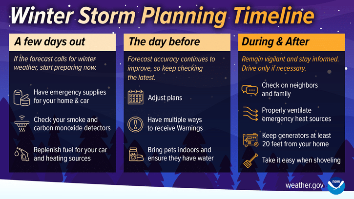
Recommended Preparations:
- Check outdoor pipes and faucets for freeze protection
- Bring pets indoors during coldest periods
- Protect sensitive plants
- Prepare for potential ice on roads and bridges
- Have alternative heating sources ready if power is disrupted
- Stock up on necessary supplies before Friday
The weather service will continue refining the forecast as the weekend approaches and more detailed information becomes available.
Author

Related Articles
Winter Storm Watches, Warnings likely as dangerous ice, cold threatens Kerr County this weekend
The National Weather Service now forecasts “moderate to high probability” of a wintry mix of freezing rain and sleet beginning by 6 AM Saturday, with ice accumulations ranging from a trace to one-tenth of an inch. Areas of the Hill Country could see temperatures remain below freezing for 48 hours or more.

Arctic front to bring freezing rain, dangerous cold to Kerr County this weekend
The National Weather Service forecasts a sharp temperature drop on Friday night, with lows plummeting to 27 degrees after a daytime high of 63. Saturday’s high is expected to reach only 36 degrees, with rain likely transitioning to freezing rain as the Arctic air settles over the region.

The Lead Live Podcast: Monday, Jan. 19, 2026
The episode featured Schreiner Communications Director Michael Bennett, Women’s Beach Volleyball Coach Hannah Thrasher, and Women’s Flag Football Coach Colby McCoy.
Comments (0)
There are no comments on this article.