
A flood likened to a hurricane, tornado
The region’s karst terrain is shaped by the dissolution of soluble rocks like limestone which serve as conduits for rainfall that feeds the Edwards Aquifer. However, karst terrains are also prone to flash flooding.
The July 4 flood was a natural disaster, but could land management changes prevent future tragedy? Experts from across Texas weigh in on about some of the reasons this event was so deadly
After a devastating event like the July 4 flood, it’s natural to wonder, “What could we have done to prevent this?”
It’s a complicated question as there are many factors to consider. Sudden rain squalls and thunderstorms are common occurrences in Kerr County and in the rest of the Hill Country. Flooding is also common, although the severity of the July 4 flood is not.
Over the past two weeks, we’ve been speaking with geological and related experts about the region’s landscape and geological features that may have contributed to the severity of the flood. We also traveled the length of the Kerr County flood area, from west Hunt, where the North and South Guadalupe headwaters begin, continuing east to where they converge, and downstream to east Hunt, where the hills and limestone cliffs narrow, creating a funnel, before widening again as the river approaches Ingram.
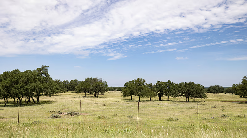
The drive is harrowing. There’s a line of demarcation where damages began near the Bone Yard area, increasing but still scattered in the Mo-Ranch area, and then worsening in the miles that follow where the north and south headwaters merge. The drive through eastern Hunt is usually a meandering drive of picturesque river crossings, green pastures and shady copses of bald cypress, oak and juniper trees. Now the drive shows a path of destruction fed not only by the river but also by roadways and other manmade features that channeled overflow from creeks, springs and other landscape features filled beyond capacity onto roadways, properties and the river..
With their varying areas of specialty, the experts we spoke with didn’t agree on everything. There are points of contention around historical terrain facts, the immediate and long-term impact of invasive plant and animal species on riparian management, and other issues.
However, there is consensus on two important points: 1) Nothing could have stopped this flood, and 2) changes in land management practices must begin now to prevent, or at least mitigate, the effects of a disaster like this in the future.
Looking back, a specific and terrible series of events had to align to create this flood, and, in part, the terrain that makes the area such a beautiful location is also the reason it became so deadly.
“Karst terrains typically have thin soils and steep slopes, both of which amplify flooding, said Robert Mace, executive director of the Meadows Center for Water and the Environment at Texas State University. “With thin soils, it doesn’t take as much rain to saturate. Once saturated, water runs off the landscape and into drainages, streams, and rivers. The steep slopes add speed to the runoff, hence the flash flooding we see.”
Kerr County lies within the southeastern region of the Edwards Plateau, one of ten ecological regions in the state. The region’s karst terrain is shaped by the dissolution of soluble rocks like limestone which serve as conduits for rainfall that feeds the Edwards Aquifer. However, karst terrains are also prone to flash flooding.
“Karst terrains typically have thin soils and steep slopes, both of which amplify flooding, said Robert Mace, executive director of the Meadows Center for Water and the Environment at Texas State University. “With thin soils, it doesn’t take as much rain to saturate. Once saturated, water runs off the landscape and into drainages, streams, and rivers. The steep slopes add speed to the runoff, hence the flash flooding we see.”
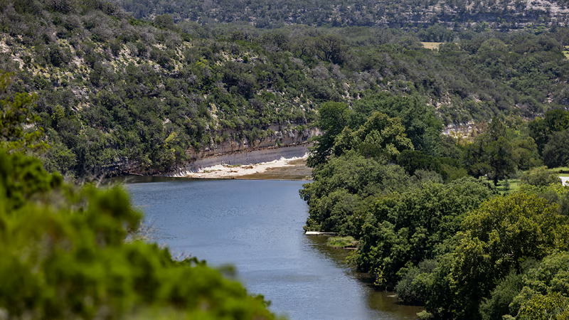
A zone of faults from Del Rio to north of Waco, the Balcones Escarpment created the wooded hills of Central Texas, while ancient seas that eroded soft sediments to expose limestone and dolostone formed the exposed limestone cliffs. These features magnified the intensity of the flood as heavy rainfall focused on a fixed location just above the start of Hunt’s hills and canyons that would serve to funnel water downhill.
There are other factors to consider as well.
Karst systems feature numerous springs, sinkholes and caves. During heavy rainfall, water is absorbed into the ground even as surface water may grow. Stormwaters can drain into sinkholes and caves and feed into springs, which are natural outlets for groundwaters. When these drainage systems exceed capacity, flash flooding occurs.
Many factors can influence the capacity of natural drainage systems, including vegetation, recent weather conditions, and urbanization. Focused on caring for land areas that border water bodies like the Guadalupe River, riparian management is the practice of managing vegetation and soil in ways that protect surface and groundwater quality and help prevent floods.
“Well-vegetated hillsides can serve as the first line of defense to help slow rains,” said Elizabeth McGreevy, Project Bedrock Founder, who specializes in vegetation management.
“Well-vegetated hillsides can serve as the first line of defense to help slow rains,” said Elizabeth McGreevy, Project Bedrock Founder, who specializes in vegetation management.
“Many landowners continue to clearcut and overgraze these lands because they have not received proper guidance on karst country best management practices,” she said. “They have been taught by agencies, the media, real estate agents, and their neighbors, that woody vegetation, especially mountain cedars, are bad. So they clear hillsides with shallow soils, exposing them to our hot sun and flooding rains.”
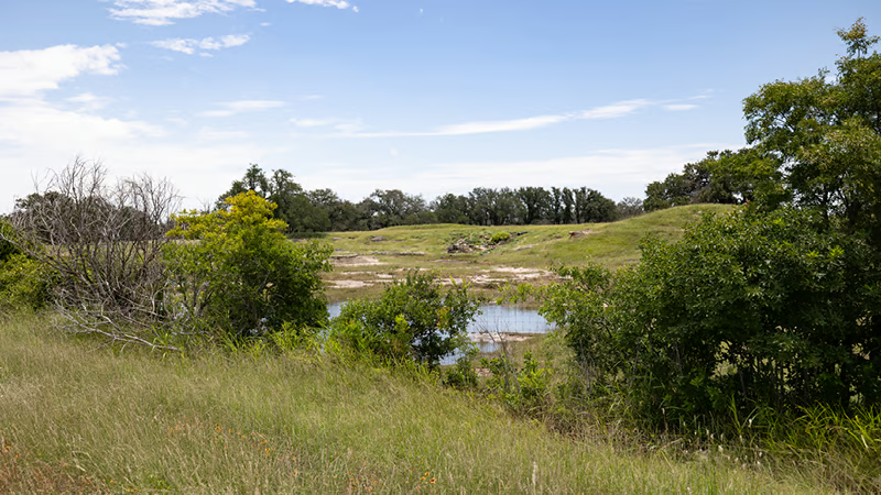
Project Bedrock, an Austin-based nonprofit organization dedicated to teaching landowners nature-based solutions for responsible karst land management, partners with The Watershed Association and with advisors from Texas A&M, Texas State University and other organizations. The nonprofit focuses on nature-based solutions that include dense vegetation coverage and opening of plugged sinkholes and caves.
Karst soils are very shallow but when left exposed, they erode and/or develop a hard crust, which reduces infiltration. Despite this, many watersheds, including those around the Guadalupe River, were cleared of their dense, woody vegetation between 1995 and 2005, McGreevy said, adding that for decades, the USDA’s Natural Resources Conservation Service (NRCS) paid landowners to clear their cedars.
The Wilcox Ecohydrology Lab at Texas A&M proved that significantly more rain infiltrates beneath woody vegetation than under the sparse grass now commonly found on watershed hillsides, she added. “Their research also proved 20-times more subsurface waters move under the trees than under the grass.”
Images of the watershed above Camp Mystic show some degraded vegetation conditions and imagery of west Hunt also show large areas of deforestation. However, Steve Nelle, a natural resource specialist, wildlife biologist and Project Bedrock advisor, qualified that the upper Guadalupe catchment is primarily “vast rolling upland divide, not canyonland.”
“These rolling divides were not historically wooded,” he said. “It was more a mixed savanna dominated by oak and lots of grassed open areas in between. The brush clearing and burning that is done on this landscape type is an attempt to maintain a natural balance between wooded and grassland. Oaks are not removed.”
He also pointed out that the largest area that appears cleared of woodlands is a large private ranch with “exceptionally good management, good grass cover and good hydrologic conditions.”
In the canyonlands that become more prevalent moving into east Hunt, woodlands are natural and an important part of healthy riparian management. He also reiterated that the kind of rainfall received [July 4] can be likened to “other natural disasters such as hurricanes, tornadoes, extreme drought, or extreme freezes/ice storms. There is nothing man can do to prevent or lessen these natural events.”
That said, proper land management practices that meet the specific needs of the region’s karst terrain could save lives in the future.
In addition to common misconceptions around the benefits of cedars and other trees for hydrologic conditions, there are also concerns with the long-held practice of plugging sinkholes and caves. In fact, according to Nico Hauwert, former city of Austin geohydrologist, this practice has been contributing to increased flooding potential since the 1840s.
“Every ranch I’ve assessed on the Edwards Aquifer recharge zone (and some further west on other limestones) had stock ponds created from plugging the bottom of sinkholes (skylight entrances into caves),” Hauwert said. “These stockponds in sinkholes are like plugging a bathtub, but some of the stockponds I’ve unplugged drain 200 acres or more. No agency that I know seems to be active in unplugging the thousands of plugged sinkholes that no longer support livestock.”
Many caves were filled to dispose of trash or to eliminate fall hazards for livestock and people. Some were filled for urbanization, although many of these were later converted to water quality ponds.
“These holes need to be reopened to allow massive amounts of hillside stormwaters to enter the karst,” McGreevy also said. “Not only would this help raise regional groundwater levels, it would dramatically help mitigate floodwaters.”
The Texas Speleological Survey (TSS), which maintains a comprehensive karst inventory for Texas, documents 227 karst features in Kerr County, including 108 caves, 15 sinkholes/cavities, 103 springs, and 1 other/undefined feature in their 2020 database. As the practice of plugging features like caves or sinkholes often occurs on private property, no specific regional data could be found. But the prevalence of the practice across the Hill Country suggests there may be opportunities to unplug and increase drainage resources like these in the future.
“While the historic management practice was to keep water at the surface in cavernous areas, now that is not ideal practice,” Hauwert said. “Instead, having water infiltrate into the soil reservoir and aquifer is best for many reasons.
Additionally, Hauwert reiterated the negative impact on soils resulting from widespread tree clearing that began in the 1800s, as property owners changed natural wooded landscapes to grassy plains for cattle.
Studies have repeatedly shown that trees greatly reduce runoff and flooding, he said, explaining that their roots channel water underground, they help keep soil in place, slowing runoff and erosion, and they create their own reservoirs during wet periods.
As we grieve the loss of lives and slowly rebuild our community, we will need to look to the future and consider the riparian management practices that meet the specific challenges and opportunities of the region’s karst terrain. While experts in this region’s ecosystem can provide these valuable insights, much of the management also falls on private landowners, who depend on government agencies to provide both guidance and funding.
Ensuring these agencies are accessing guidance of field specialists that can provide the right solutions for the region’s karst systems is critical, McGreevy said, adding that government agencies, especially the NRCS, needs to create less generic, more regionally-specific funding opportunities.
Lastly, every expert we spoke with stressed the importance of not building within the flood plains.
“Do not rebuild in the 200 to 500 year floodplain,” Nelle advised, adding that the Hill Country has lost a great deal of its topsoil over the past 150 years, reducing its former capacity to hold water.
McGreevy also reiterated this message, adding that any structures that are built within the 500 to 1,000 year flood plain need to be solid concrete or solid rock.
After seeing firsthand the unbelievable path of destruction forged by the floodwaters, both in Hunt and downstream in Kerrville and Center Point, it’s clear that changes and likely others will need to be made to ensure this type of tragedy isn’t repeated.
Related Articles

Kerrville Rotary serves up pies to fight polio Oct. 22
“We’re just trying to raise money and awareness that it’s not gone,” event chair Kristy Vandenberg said on Friday’s episode of The Lead Live.
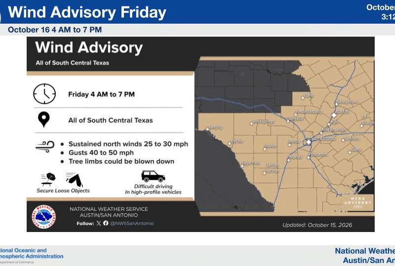
Wind advisory issued for Friday as strong cold front moves in
The front is expected to arrive a little earlier than first forecast, sometime after midnight. Winds will shift to the north at 15 to 25 mph, with gusts up to 35 mph. There’s a 50% chance of showers after 1 a.m., but rain amounts in Kerr County should be light, less than a tenth of an inch.

Texas political notebook: Talarico back on the trail, Paxton’s Dubai problem and a Senate race that keeps tightening
Republican nominee Ken Paxton’s campaign demanded “proof of life,” launched a tip line for Talarico sightings and promoted missing-person posters.
Comments (0)
There are no comments on this article.