
Kerrville steps up flood readiness ahead of Thursday’s heavy rain threat
City crews have staged barricades at low-water crossings, bridges and flood-prone roads, and more barricades are ready to go up as needed. Streets and Parks and Recreation workers have filled several hundred sandbags and placed pallets of them in flood-prone areas.
The city of Kerrville has moved to a higher level of readiness ahead of the heavy rain, flash flooding and severe weather expected later this week, city officials said Tuesday.
City crews have staged barricades at low-water crossings, bridges and flood-prone roads, and more barricades are ready to go up as needed. Streets and Parks and Recreation workers have filled several hundred sandbags and placed pallets of them in flood-prone areas.
The city cited forecasts calling for 2 to 4 inches of rain across the region, with isolated totals up to 8 inches. Thursday looks like the day with the most rain, but it’s still unclear exactly where the heaviest rain will fall.
“The City is preparing for the potential impacts of this weather event while continuing to closely monitor the forecast,” city officials said. “Our priority is life safety. Residents should remain weather aware, avoid unnecessary risks and be prepared to act if conditions change.”
How the city is preparing
- Emergency Management is coordinating with Kerr County and other public safety partners. It is also contacting designated shelter sites to make sure they’re ready if evacuations become necessary.
- Streets crews have been clearing drainage areas and making temporary repairs to infrastructure damaged in earlier flooding. They’ll stay on standby through Sunday and can move to extended shifts if needed.
- Fire and EMS are readying swift-water rescue resources, including a boat staged for quick deployment. State water-rescue teams are also in the area, and the city can request more help if needed.
- Public Works is monitoring water and wastewater facilities and utility lines that rising water could affect. The city is also prepared to shift how it runs the water system if the flooding affects the surface water treatment plant.
- Information Technology is preparing communications and data systems in case the Emergency Operations Center is activated.
The city also repeated a standing warning: never drive around barricades or try to cross a flooded road. Water over a roadway can be deeper and faster than it looks.
City officials said they’ll keep coordinating with Kerr County and state partners and will share more as the forecast sharpens. Residents should watch the city’s official channels and trusted weather sources for updates.
Author

Related Articles
Flood Watch issued for Kerr County; state stages medical teams, National Guard vehicles in Kerrville
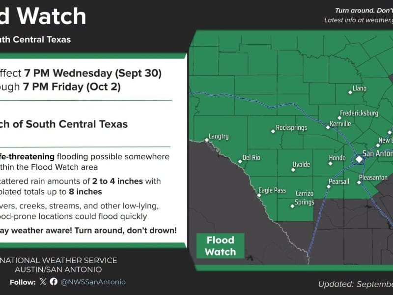
The watch, issued Tuesday morning by the NWS Austin/San Antonio office, covers 28 counties, including Kerr, Bandera, Gillespie, Kendall, Real and Edwards. Forecasters expect rainfall totals of 2 to 4 inches from Wednesday evening through Friday, with isolated amounts up to 8 inches. Kerrville is among the cities the NWS lists as likely to see flooding.
Forecasters: Up to 8 inches of rain possible in Hill Country as flood threat builds for Thursday
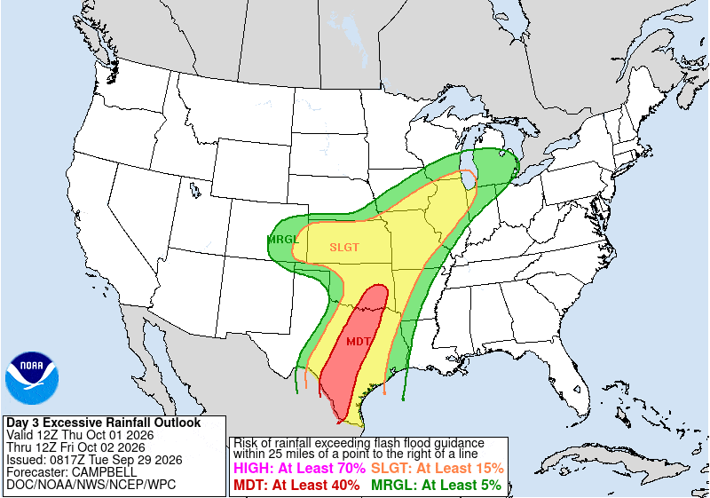
In its overnight forecast discussion, the NWS Austin/San Antonio office said widespread rainfall of 2 to 4 inches is possible Thursday into Friday, with local amounts up to 8 inches. Forecasters said models favor Thursday, Thursday night and early Friday morning for the highest totals.
Forecasters raise flash flood concerns for Wednesday night into Thursday
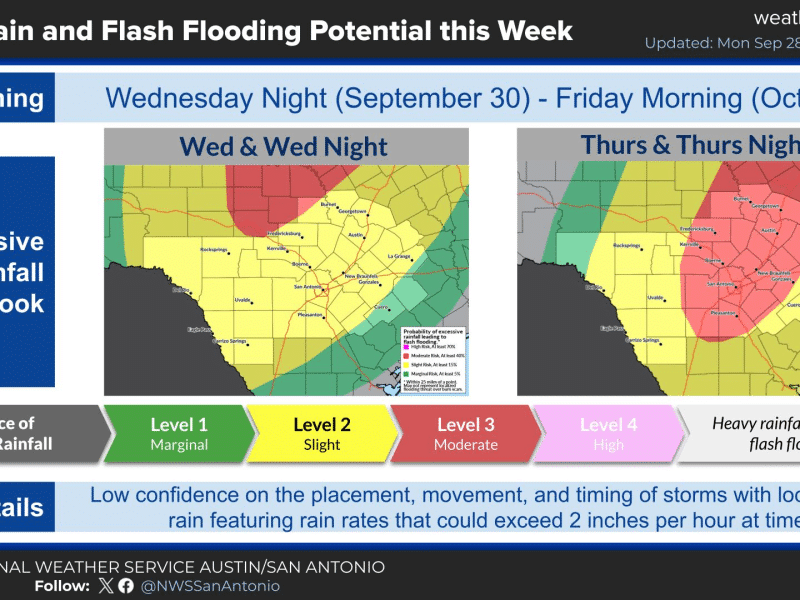
“Given the setup of deep moisture, a strong upper low and frontal boundary, this seems very reasonable,” forecasters wrote.
Comments (0)
There are no comments on this article.